A unique long-distance journey connecting landscapes, communities, and people across Tasmania.
WHAT IT IS
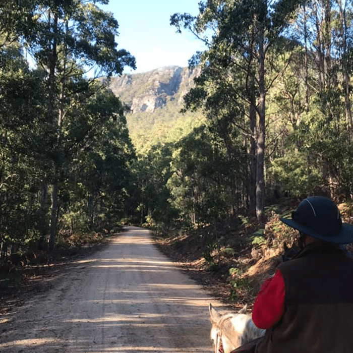
The Tasmanian Trail is a 480km multi-use route stretching from Devonport in the north to Dover in the south. It offers a diverse experience across forests, highlands, rivers, and rural landscapes.
Designed for walkers, cyclists, and horse riders, the trail provides a flexible journey—whether for short sections or full-length expeditions.
The trail is designed to offer a rich mix of recreational, cultural, and nature-based experiences.
Travellers pass through small towns, explore remote landscapes, and experience Tasmania beyond traditional tourist routes.
From peaceful countryside rides to challenging terrain and changing weather conditions, every journey is unique.
HOW THE TRAIL WORKS
Multi-Use Access
Open to horse riders, cyclists, and walkers
Flexible Journey
Complete the full trail or explore sections
Connected Communities
Route passes through towns with local services
Real Conditions
Expect varied terrain, weather, and limited facilities
Why the Trail Exists
The trail was developed to create a continuous route through Tasmania that connects people with the land while supporting regional communities.
Inspired by long-distance trails in Australia, it brings together forestry tracks, rural roads, and public and private land access into one continuous experience.
Its purpose is to promote outdoor recreation, regional tourism, and appreciation of Tasmania’s diverse environments.
Powered by Community
The trail is managed by the Tasmanian Trail Association, a volunteer-led organisation supported by local communities, landowners, and government bodies.
Access to the trail relies heavily on cooperation with private landowners and regional partners, making respect and responsible use essential.